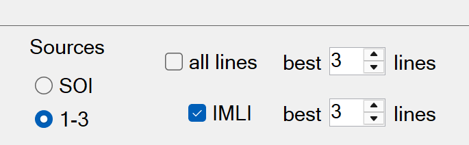
IMLI inversions incorrect under certain conditions
- Issue: In the inversion configuration: if the IMLI option is checked and also the “all lines” option is checked, the IMLI inversions will be incorrect when the inverted cell contains 4 or more lines. The temporary workaround is to uncheck the “all lines” checkbox in the inversion config, and keep the number of lines equal for both regular and IMLI inversions as shown here:
- Versions affected: 15.3.29 and lower
- Sensor platforms affected: all
- Severity: high
Client machine cannot access Project Settings
- Issue: When BTField is networked, a client machine cannot access the Project Settings to switch its AQ Cfg.
- Versions affected: 15.3.25 and lower
- Sensor platforms affected: all
- Severity: low
Secondary Digs not getting selected
- Issue: Under certain conditions, secondary digs may not get selected due to an unused database row lock that can intermittently block secondary dig selection.
- Versions affected: 15.3.25 and lower
- Sensor platforms affected: all
- Severity: medium
hdf5 import not updating survey extents
- Issue: The hdf5 import does not update the survey extents. This prevents hdf5 imported surveys from being included in an SU survey.
- Versions affected: 15.3.25 and lower
- Sensor platforms affected: all
- Severity: medium
Auto-Pick not ignoring SRA polygons
- Issue: The Targ Detect function will pick targets inside SRA polygon types.
- Versions affected: 15.3.25 and lower
- Sensor platforms affected: all
- Severity: low
Tx-Rx pairs setting not retained
- Issue: The Tx-Rx pairs setting in the Targ Detect function is not retained after saving the PROCESSING interface
- Versions affected: 15.3.25 and lower
- Sensor platforms affected: all
- Severity: medium
Extra Merge function in Flow
- Issue: When restoring the AQ interface, an extra Raw-to-Merged step gets added to the P Flow1.
- Versions affected: 15.3.25 and lower
- Sensor platforms affected: all
- Severity: medium
Stretched plots on Function Test Report
- Issue: The Function Test report has stretched plots and fonts.
- Versions affected: 15.3.19 and lower
- Sensor platforms affected: all
- Severity: low
Installer not updating CompilerServices.UnSafe.dll
- Issue: When upgrading to v15.3.19 some machines may get a message saying BTField cannot find the CompilerServices.UnSafe.dll. The workaround is to:
- Uninstall the BTField application in Windows Start/Installed apps. Do NOT uninstall SQL Server. Also, do NOT delete the c:\BTG Workspace folder.
- Run the v15.3.19 msi installer again.
- Versions affected: 15.3.19 only
- Sensor platforms affected: all
- Severity: low
Elevation Offset in Merged H5 V1 Exports
- Versions affected: 15.3.19 and lower
- Sensor platforms affected: all
- Severity: Small elevation offset in exported sensor positions; effect is negligible under low-roll survey conditions and increases with terrain-induced roll.
Description
When BTField exports merged H5 V1 data in v15.3.19 or lower, the Elevation field is written at the position of the first receiver (Rx #0) rather than at the GPS antenna. This introduces a lever arm offset that includes a lateral (cross-track) component. Because the offset is attitude-dependent, it produces spurious sensor height variation that cannot be removed by a simple constant correction.
When BTField re-imports this data, the import assumes Elevation is at the GPS antenna location and applies the lever arm correction a second time. This results in a double lever arm correction on the elevation values.
UTM coordinates (Easting, Northing) are not affected — they are computed directly from GPS Lat/Lon without a lever arm offset.
Affected Datasets
This issue affects any dataset exported as merged H5 V1 from a multi-receiver array where the first receiver is not co-located with the GPS antenna.
Any hdf5 dataset that has already been exported and re-imported into BTField v15.3.19 or lower contains incorrect elevation values that cannot be corrected in place. Users should re-import affected merged H5 V1 data using BTField v15.3.24 or higher as it will apply the correction during import.
Additional Note
The merged H5 V1 export of v15.3.19 or lower also writes a hardcoded Geoid Separation value (−33.9 m) that may not match the actual survey location. This does not affect sensor Elevation but will produce an incorrect Height Above Ellipsoid (HAE) value in the file.