Current release
v12.24.40 - 211105
- Change to ensure the “Stop line” action of a command sequence gets executed after the last merge segment has been fully committed to disk.
v12.24.37 - 211103
- Ability for command sequences to auto-send at Start line and at Stop line.
v12.24.36 - 211007
- Support for new UT4-NATA-2 project (attached). Users should install this upgrade first, then import the project.
v12.24.35 - 211006
-
New checkbox option called “Validate Fix on P and IVS” in Project Settings. This allows users to turn ON/OFF the validation of GPS Fix when collection Production and IVS surveys. Almost all projects will have this option turned ON as shown here:

Some projects, such as UT4-TEMA-2, use positional systems that do not generate regular GPS Fix values. If this is the case, the option should be turned OFF to by-pass GPS validation.
- Registration of UT4-TEMA-2 project.
- Fix for Linear percent stretch causing display of saturated colors only.
v12.24.34 - 211004
- Fix for profiles disappearing during data collection.
- Fix for indicator display issues happening when Command Button indicators and Data Extraction indicators are on the same indicator bar.
- Improvements for accuracy of calculated time stamps.
v12.24.32 - 210916
- Validation logic added to check for duplicate simulator stream types when attempting to create sim files during data collection.
- Fix for error encountered when running the Auto-Invert flow after setting synthetic seeds.
- A new “Wnd Sync Offset” setting has been added to the Input Stream settings. This setting determines the fractional portion of the incoming data window that will be used to determine the first calculated time for the data window. For almost all projects, this setting will be zero.
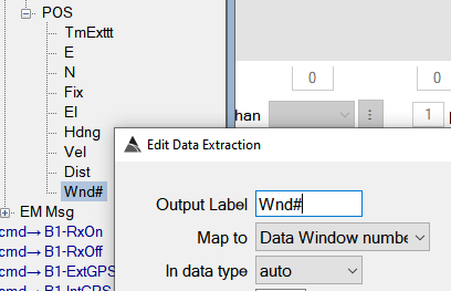
- A new Data Window number extraction is now available for the POS sensor. This extraction will assign a data window number to each raw positional reading.
v12.24.31 - 210916
-
Support for recalculating inversion metrics without having to re-invert:
Right click on the Inversion Results View and select “Recalculate Metrics” to begin a batch recalculation of all metrics.
Note: This will only be required when Black Tusk makes a modification to any of the core metric calculations. Customers will be notified when it is necessary to perform this operation.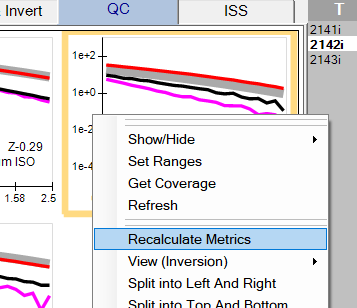
-
Support for changing Survey Type:
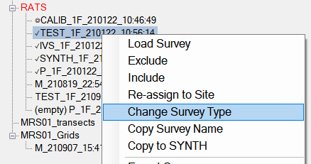
Since surveys can sometimes be collected using an incorrect Survey Type, users now have the ability to change it. For example if a production Survey was incorrectly acquired as a TEST type, the user can right click on it and select “Change Survey Type” to set it as a Production (“P”) survey type.
-
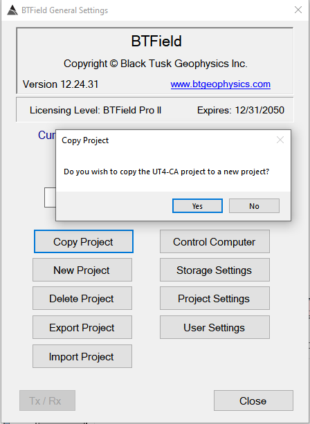
Support for copying a BTField project to a new project:
This feature can help reduce the amount of time required to build a new project. The copied project will be unregistered, so it will allow the user to add/delete sensors. Once finished, the new project can be exported and sent to Black Tusk for registration.
-
Additional performance improvement for importing/copying BTField projects.
-
Fix for Manual Commands not trimming off empty bytes.
-
Support for single and multi-source synthetic seeding:
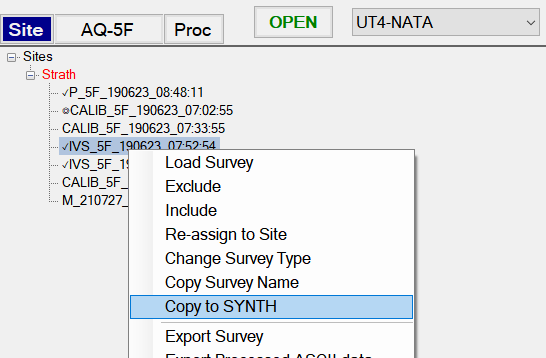
Synthetic seeding must be performed in a SYNTH survey type. When a SYNTH survey is collected it is typically an acquisition of the background which serves as a noise base for the seeding. If a SYNTH survey has not been collected yet, the user can copy an existing survey to a SYNTH type. For example an IVS survey from the UT4-NATA Classifier system can be selected and the user can “Copy to SYNTH” as shown below:
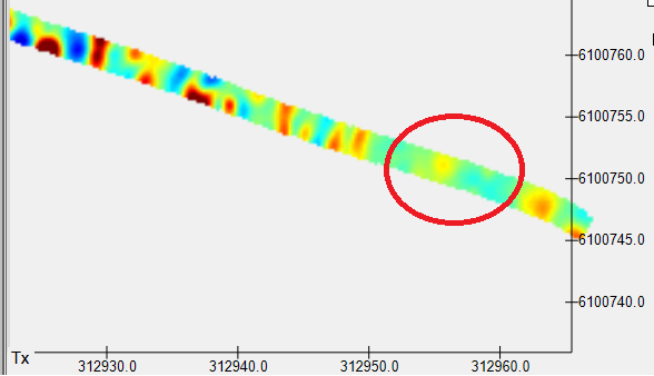
After we open the SYNTH survey, we could decide to set a synthetic seed in the area of the red circle (for example):
To get started, go to the MQO tab and ensure you have a Library configured and enabled first. After that, click on the “Set Seeds” button:

Create a new Synthetic Seed configuration using the New button, or the Import button if you have your seeds defined in a csv file. We will import from csv in this example.
Click on the Import button as shown here:
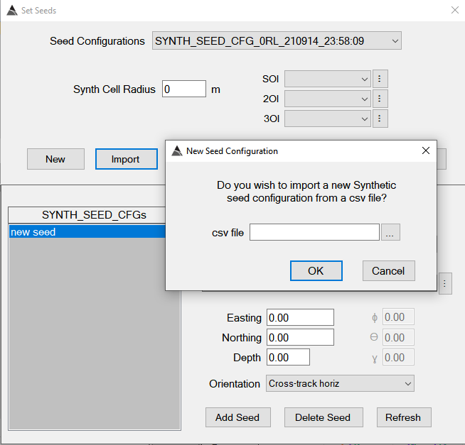
The csv file should have the following format (a header row is not required). The exact library Item names should be specified. In this example, we have set three sources close to each other because we want to generate a multi-source scenario. Note that the seed items only require an integer value specifying the seeded orientation:

Once the seed configuration is imported, a Synth Cell Radius can be set, indicating the footprint of the synthetic data. BTField will automatically generate synthetic data for one, two or three sources, depending on how many items are clustered within the specified SYNTH cell area. In our example we will set a radius of 1.6 m, therefore all three of our seed items will be used to generate a three source synthetic seeding.
Also note that after import, the seed configuration can be modified. For example If any of the csv library items cannot be automatically found, they can be manually selected after the import.
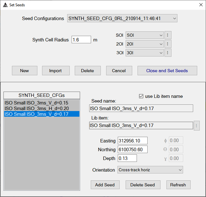
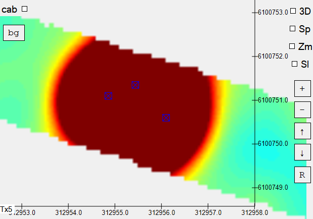
Now we can click on the “Close and Set Seeds” button to generate the synthetic data. Here is the result of our synthetic three source seeding.
The ground truth location of the seeded sources are colored in blue:
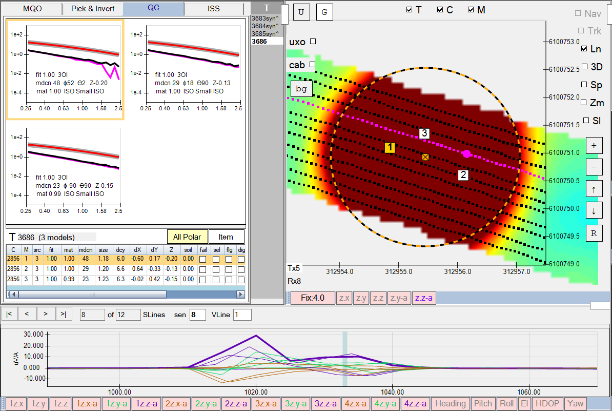
We can now invert the synthetic data to determine our accuracy in this three source scenario. Here are the results of a three object inversion (3OI). In this case the UT4-NATA system performs quite well, correctly locating all three sources very close to the ground truth locations, ground truth orientations, and library matches.
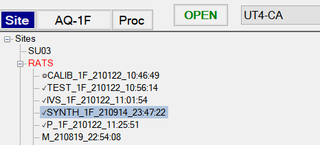
Here is another example of synthetic seeding, but this time we will use the UT4-CA Screener system. As we did previously, we can copy one of the IVS surveys to a SYNTH type and open it.
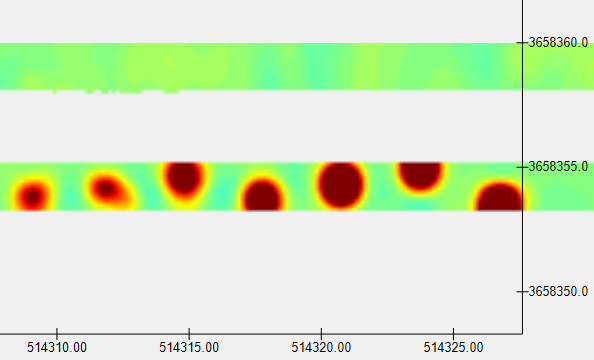
We can use the northern lane for our synthetic seeds:
In our csv file we have configured a single source, a three source, and a two source seeding as shown here:

Here is a look at the data after generating the seeds:
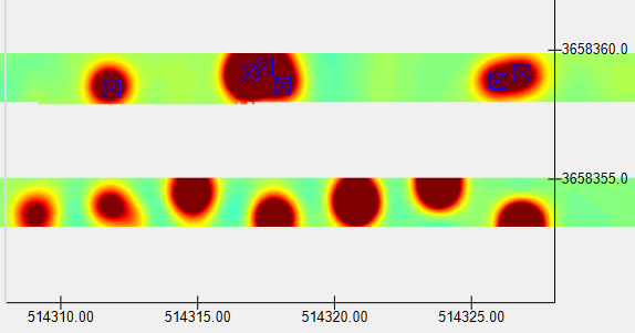
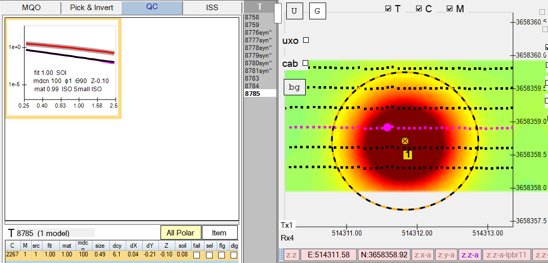
Here is the inversion result of the single source (West side), giving us good accuracy:
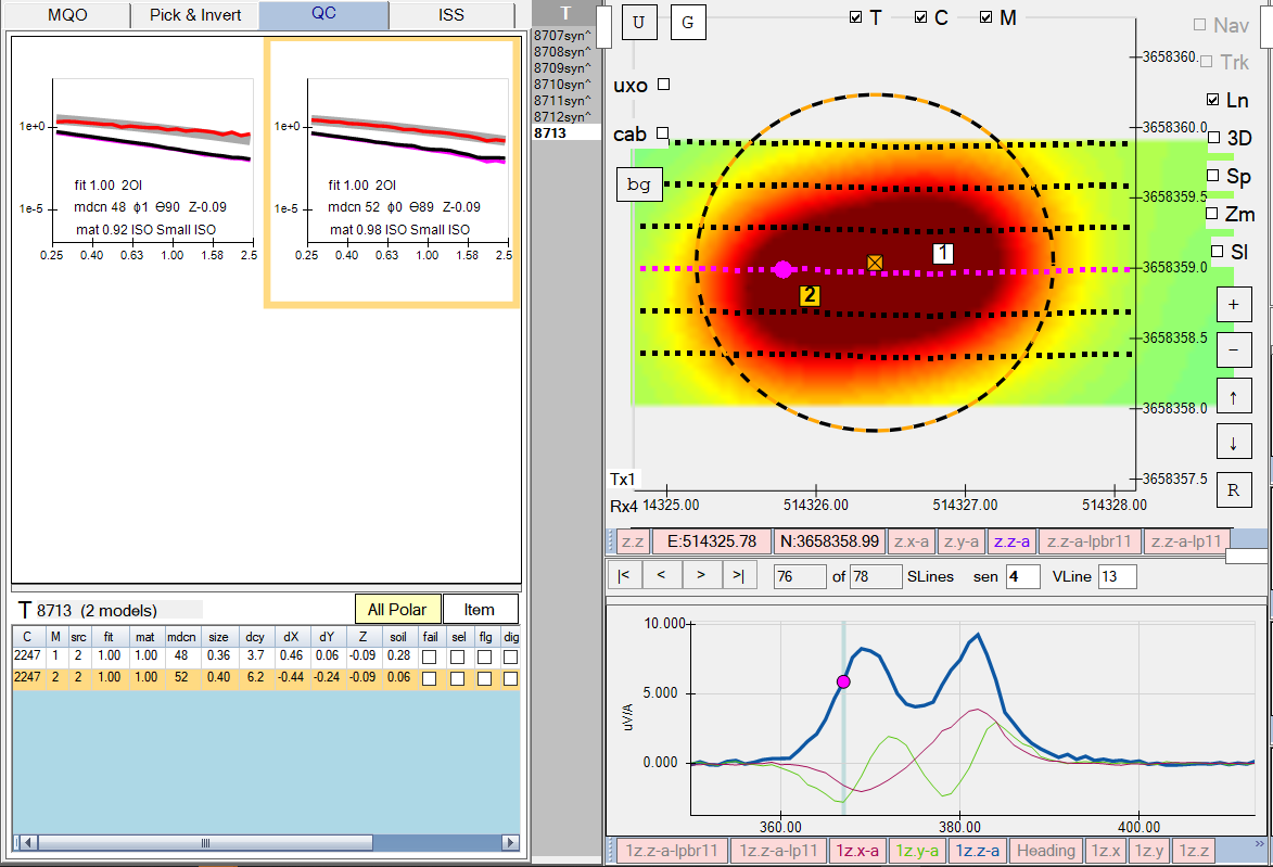
….and here is the inversion result of the two source seeding (East side), indicating both sources were correctly located in their ground truth horizontal cross-track orientations
v12.24.24 - 210802
- Fix for ASCII targets not exporting.
- Fix for GeoTiff not exporting with correct projection and transform settings to ensure positional accuracy across the entire GeoTiff.
v12.24.23 - 210722
- Fix for command sequences causing connection issues.
v12.24.22 - 210721
-
Fix for survey export not working when the associated site is not the Active Site.
-
New option to toggle the delimiter and command setting interfaces between “Decimal” and “ASCII”.
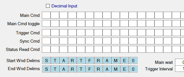
- Here is an example of the Decimal interface option being selected:
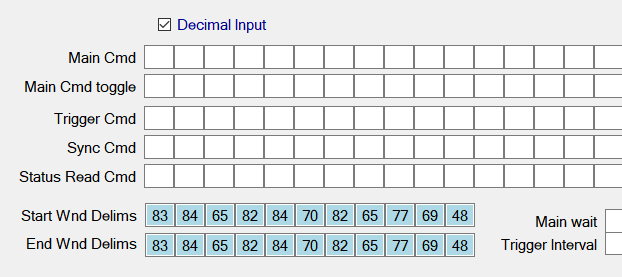
- here it is again with the Decimal option unchecked (i.e. ASCII option):
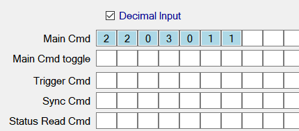
- Some commands are more suited to the decimal interface. For example the RxOn command, which sends numbers:
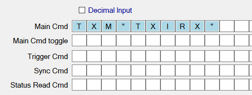
…whereas the TxOn command is easier to set in ASCII mode:
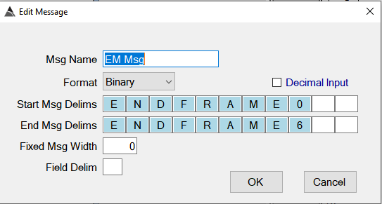
- The option is also available at the message parsing level:
…and it’s also available at the sensor parsing level. Note, the Lord Microstrain ATT sensor shown here would be set using the Decimal option, since it has to send values like 28 and 128, which do not translate to readable ASCII characters:
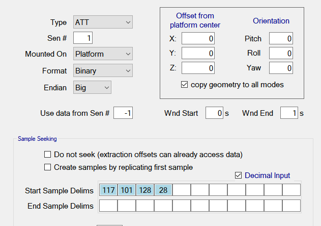
- There’s no harm in toggling between them though. The ASCII interface for this ATT sensor would just look like this below (with the 128 and 28 now non-readable in ASCII, but still highlighted in blue to indicate a value is there):

- Here is an example of the Decimal interface option being selected:
v12.24.21 - 210720
- Memory reduction for grids. A float data type is now used for the gridded value instead of a double type.
-
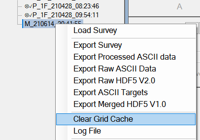
Note: Since permanent grids are now loaded and saved with the float data type, users will need to clear all their old permanent grids using the “Clear Grid Cache” menu item off the survey tree view.
-
- Fix for northing shift on GeoTiff export.
- Fix for shift on detected target locations when running Auto-Detect flow on very large grids.
-
Note: The shift occured when the grid exceeded 70,000 pixels in height (northing direction), which is equivalent to a distance of 2.8km for a grid spacing of 0.04m. The new limit is 100,000 pixels in height, with a new warning message if anyone goes over that limit (and it also prevents them from creating the grid).
-
- Fix for inversion errors when matching against library items with long names.
- Application wide text entry limits according to database field limits.
- Support for stepping through target and cell lists using arrow keys.
- Fix for extra seed getting added during csv import of Seeds.
- Fix for errors encountered on Seed Configuration deletion.
- Added BTField project name to top of log file.
- New menu item in Site tab to “Copy survey name”
- Logic to ensure only extracted members are exported with Raw ASCII export.
- Raw ASCII export now exports a copy of the log file and survey comments also.
- Fix for btg file sometimes not exporting when the survey is loaded and has inversions completed.
- Multi-select support for Survey tree view. This provides multi-select capability for the following menu items:
- Exclude survey
- Include survey
- Re-assign to Site
- Copy survey name
- Export Survey
- Export Processed ASCII
- Export Raw ASCII
- Export Raw HDF5 V2.0
- Export Merged HDF5 V1.0
- Delete Survey
Note: For multi-selecting on tablets, you’ll need to use the extended virtual keyboard to get the SHIFT or CTRL key held down.
v12.24.20 - 210705
- Significant performance improvement for import/export of Master surveys.
-
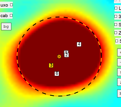
Faster rendering of model locations on grid view using square shapes instead of circular shapes. Model locations now appear as shown here:
-
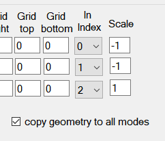
In the Data Extraction dialog, Scale values for Rx geometry are now copied to all modes when the copy geometry to all modes option is checked.
- Fix for U button (unset excluded lines button), not always removing all excluded (gray) lines.
- Fix to ensure all Command Sequences get performed last to ensure all dependent TCP and/or serial connections have been established first.
v12.24.19 - 210628
- Fix for Cumulative Distance calculation that gets performed during data acquisition.
- Performance enhancements for line rendering and point selection on large surveys.
v12.24.18 - 210626
- New checkbox in the Detrend function to optionally re-calculate the cumulative distance. All Detrend functions will have this defaulted to an ON (checked) state.
v12.24.17 - 210625
- Support for re-running the Auto-Invert flow using a different inversion mask, without requiring the user to delete all targets first.
v12.24.16 - 210621
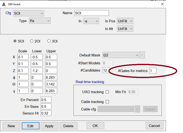
- The #Gates for Metrics parameter has been removed from the inversion configuration dialog. The time gates used for the inversion metrics will be internally determine by the application.
- The Size metric is now set internally to use the first 5 time gates that have been selected for the inversion.
v12.24.15 - 210617
- Fix for error during Auto-Detect flow where NaN grid values were not being handled correctly.
- Support for Nearest Neighbor search when encountering NaN values at edge of grid during auto and manual target picking.
v12.24.12 - 210617
- Fix for soil mf calculation.
- The soil misfit configuration has been simplified by removing the “Anomaly times” setting, since these time will always be the same as the Soil model times.
- Fix for the Merg Dist parameter in the Detect Targ function. This parameter was not being used to merge the targets detected in the active Auto-Detect flow (it was only being applied to previous runs of the flow)
- Adjustment for Size calculation.
- Support for capture, storage, and reporting of the picked grid amplitude values during manual and automated target picking.
- A new Gates for metrics parameter in the inversion configs. It defaults to 1. Typically it will be set higher, i.e. 13.
- Additional logic to catch any errors that could be thrown when capturing grid amplitudes during target picking.
v12.24.11 - 210615
-
Gridding no longer applies smoothing on LPBR and LP indicator operations, which are typically used for target picking. This allows the grid to fit more closely to the profile peaks. Before running the Auto-Detect flow again, please ensure you clear the grid cache on the Master survey as shown here:
- The “Site Polys” dialog can now be used without requiring a survey to be loaded first.
- Fix for Tracking sensor settings stepping on non-EM indicators during data collection.
v12.24.10 - 210609
- Disabled consideration of inclusion and exclusion boundaries during Auto-Detect targets flow. This will ensure that all targets are created, even if they fall outside inclusion boundaries or inside exclusion boundaries.
- Fix for error on batch Raw data export.
v12.24.9 - 210608
- Support for Set Ranges on Metrics Navigator View (ranges for all metrics).
- Empty surveys are now prefixed with (empty) on tree view.
- Raw data export will now retain the last exported folder setting.
- Raw data export will automatically skip over empty surveys, rather than stop with a message.
- Fix for Pick and Inspect not saving properly.
- Fix for Pick Invert not saving properly when user clicks on grid before inversion has completed.
- Additional validation checks to ensure soil misfit channels agree with inversion settings.
- Dynamic display of cell radius during Pick &Invert and Pick & Inspect drag operation.
- Fixes for soil misfit calculation.
- New multi-select tool for selecting/fencing a group of targets in preparation for running the Auto-Invert flow (or for deleting targets).
-
The user can click the Sl checkbox on the right side, then draw the polygon selection as shown here:
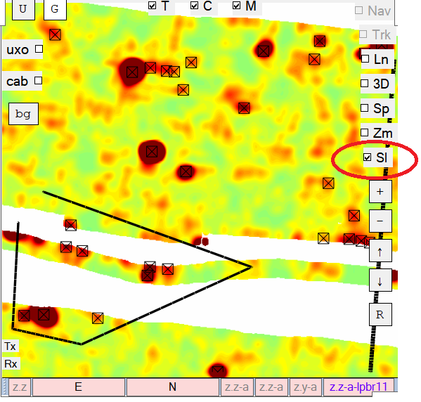
Polygon target selection tool. -
After hitting the Enter key to complete the polygon, the targets will be selected as shown here.
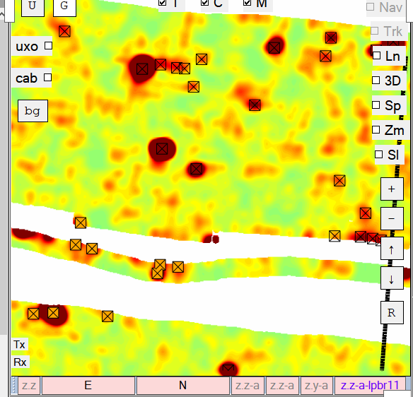
Subset of targets selected using the . -
Now the user can click the Auto-Invert button to invert only these targets.
v12.24.6 - 210531
- Support for grid display on TEST surveys when GPS Fix is poor.
- Support for using a “Source of Calculated Time” that is on a different input stream (i.e. different data consumption thread). This option will be used when sensor data is sent to BTField without any accompanying timestamp. The timestamp obtained from the other input stream will not be optimal, but it can suffice on slow moving platforms.
- Fix to ensure only the primary POS sensor (POS sensor number 1), can update the heading, vehicle position, speed, etc.
- Support for auto-removal of targets during auto-detect flow. Targets will be automatically removed if they fall outside inclusion polys, or inside exclusion polys.
v12.24.4 - 210527
- Fix for “Unsel dup” function in ISS taking an excessively long time to complete.
- Extra ISS message for “Unsel dup” function. This message indicates the total number of models that were selected due to Can’t Analyze conditions.
- Removal of unnecessary database commits during auto-invert flow, which was degrading the flow performance.
- Removal of automatic loading of results after each inversion during auto-invert flow, which was degrading the flow performance.
- Added checks to avoid unnecessary filter refresh, when filter already applied.
- Database update to adjust built-in filters (such as the “selected” filter) on older databases that may not have the correct settings for some upper bounds.
v12.24.3 - 210525
- Validation checks to ensure that selected time gate ranges for the soil misfit calculation are supported by the inverted time gate ranges.
- Database update to initialize all existing ISS filters with default values for the new Depth and Soil misfit metrics.
v12.24.1 - 210524
- Fix for Soil Misfit refresh not handling masks properly.
- Fix for GeoTiff resolution not getting set properly.
- Fix for GeoTiff getting flipped.
- Fix for GeoTiff not setting transparent color.
v12.24.0 - 210521
- Fix for Library Match values not getting updated after running the auto-invert flow.
- Additional columns for Soil MisFit and Selected status added to Cued Target List ASCII report.
- Soil misfit and Match columns have been added to the spreadsheet in the QC tab.
- Option to include/exclude polariz in Cued Target List ASCII report.
- Performance improvements for database Cell row creation and Inversion row creation during auto-invert flow.
- Fix to prevent crash on project export when a large number of function arguments are present.
- Significant performance enhancement for importing projects.