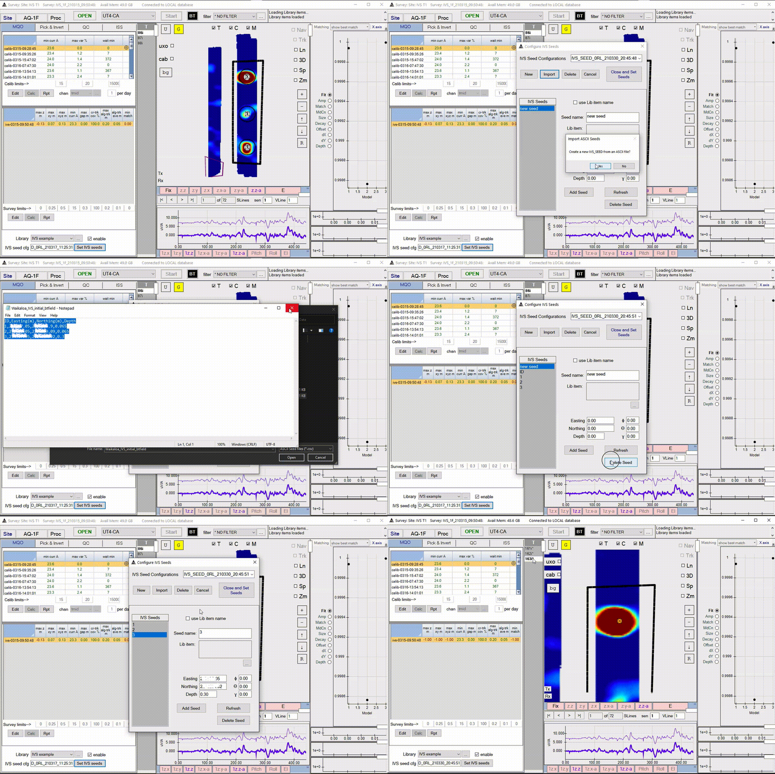
Import the Seed locations
Note: This functionality only works after a survey is loaded.
- From the MQO tab click the button Set IVS seeds on the bottom.
- Click New to add a new configuration.
- Click Import to create a new seed from an ASCII file.
- The ASCII file should be in the following format.
- A header is not required.
- 1st column should be a unique label.
- 2nd column is an Easting value in WGS84 UTM coordinates.
- 3rd column is a Northing value in WGS84 UTM coordinates.
- 4th column is a Depth value given in meters.
-
Nth column is not required
  ID,Easting(m),Northing(m),Depth
  1,657397.25,1216234.9,0.065
  2,234594.05,121322.09,0.065
  3,218397.05,1215214.92,0.3
- Once imported remove entries associated with a blank default seed and the header row.
- Click Close and Set Seeds button.
- Seed locations will be added to the map and can be navigated to using the target selection control.
